GIS Mapping
At InfraTract, we combine real estate brokerage expertise with advanced GIS mapping to give landowners a clear edge in the marketplace. Developers and infrastructure buyers want answers up front: Is the land buildable? How close is it to transmission, roads, or fiber? Where are the constraints?
By signing a listing agreement with InfraTract, we prepare professional GIS maps that highlight the strengths of your property and position it as a ready-to-develop site.
What This Means for Landowners
Professional presentation – Your property isn’t just another parcel on a map; we deliver developer-ready exhibits and analysis that get attention.
Stronger negotiating power – GIS mapping makes it clear what your land offers, reducing uncertainty and strengthening your position in negotiations.
Faster decisions – With questions about access, slope, floodplain, and interconnection points answered upfront, buyers can move quickly.
Maximized value – Well-prepared, data-backed properties command better offers and higher confidence from developers.
Our GIS expertise goes beyond what a traditional land services company provides. We specialize in utilizing proprietary datasets to laser-target parcels/ tracts with ideal characteristics:

GIS Analysis For Energy Storage:
- Analysis of TB2 arbitrage capability for 2 hour duration BESS (top 2 hours historical LMP pricing minus the bottom 2 hours of historical LMP pricing).
- Analysis of TB4 arbitrage capability for 4 hour duration BESS (top 4 hours historical LMP pricing minus the bottom 2 hours of historical LMP pricing).
- Realtime market volatility
- Ancillary Service Revenues
- Basis Risk
- Shift Factor
- Charge and Discharge Capacity at the POI under N-0 and N-1 Contingencies
- Proximity to a viable POI with desired voltage
- Slope analysis
- Geotech/ soils / karst analysis
- Access analysis
- Acreage requirements

GIS Analysis For Solar:
- Proximity to a viable POI with desired voltage.
- Export capacity at the POI under N-0 and N-1 contingency
- Basis Risk/ Curtailment
- Shift Factor
- Historical LMP pricing analysis at the POI
- Solar irradiance analysis
- Shading analysis
- Slope analysis
- Geotech/ soils / karst analysis
- Access analysis
- Project contiguity analysis for collector system
- Acreage requirements

GIS Analysis For Wind:
- Proximity to a viable POI with desired voltage
- 110m hub height wind speed analysis
- Wind shear/ Turbulence analysis
- Export capacity at the POI under N-0 and N-1 contingency
- Basis Risk/ Curtailment
- Shift Factor
- Historical LMP pricing analysis at the POI
- Slope analysis
- Geotech/ soils / karst analysis
- Access analysis considering turning radius for blade deliveries
- Project contiguity analysis for collector system
- Acreage requirements

GIS Analysis For Green Hydrogen (Solar to Hydrogen and Wind to Hydrogen projects):
In addition to the above analyses, we look at proximity to existing hydrogen or ammonia infrastructure, or ROW that could be acquired to install new hydrogen pipeline to connect to existing pipeline infrastructure or ports in the Gulf Coast.

GIS Analysis For Hyperscale Data Centers:
- Proximity to a viable POI with desired voltage.
- Load capacity at the POI
- Acreage requirements
- Analysis of potential for co-located backup generation
- Proximity to fiber carriers
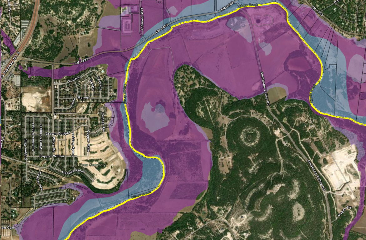
- Floodplain analysis
- Insurance risk analysis (tornado prone areas, hurricane prone etc)
- Geotech/ soils / karst analysis
- Access analysis
- Water supply analysis – groundwater availability, municipal or other water supply availability
Sample GIS Maps
Our proprietary data and GIS mapping solutions aid our clients in critical decision making.
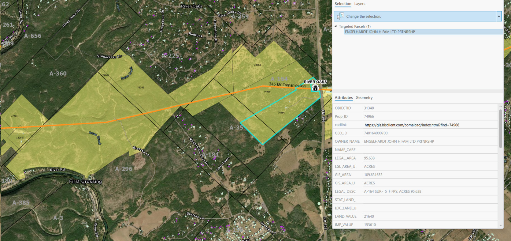
Tract Information Maps
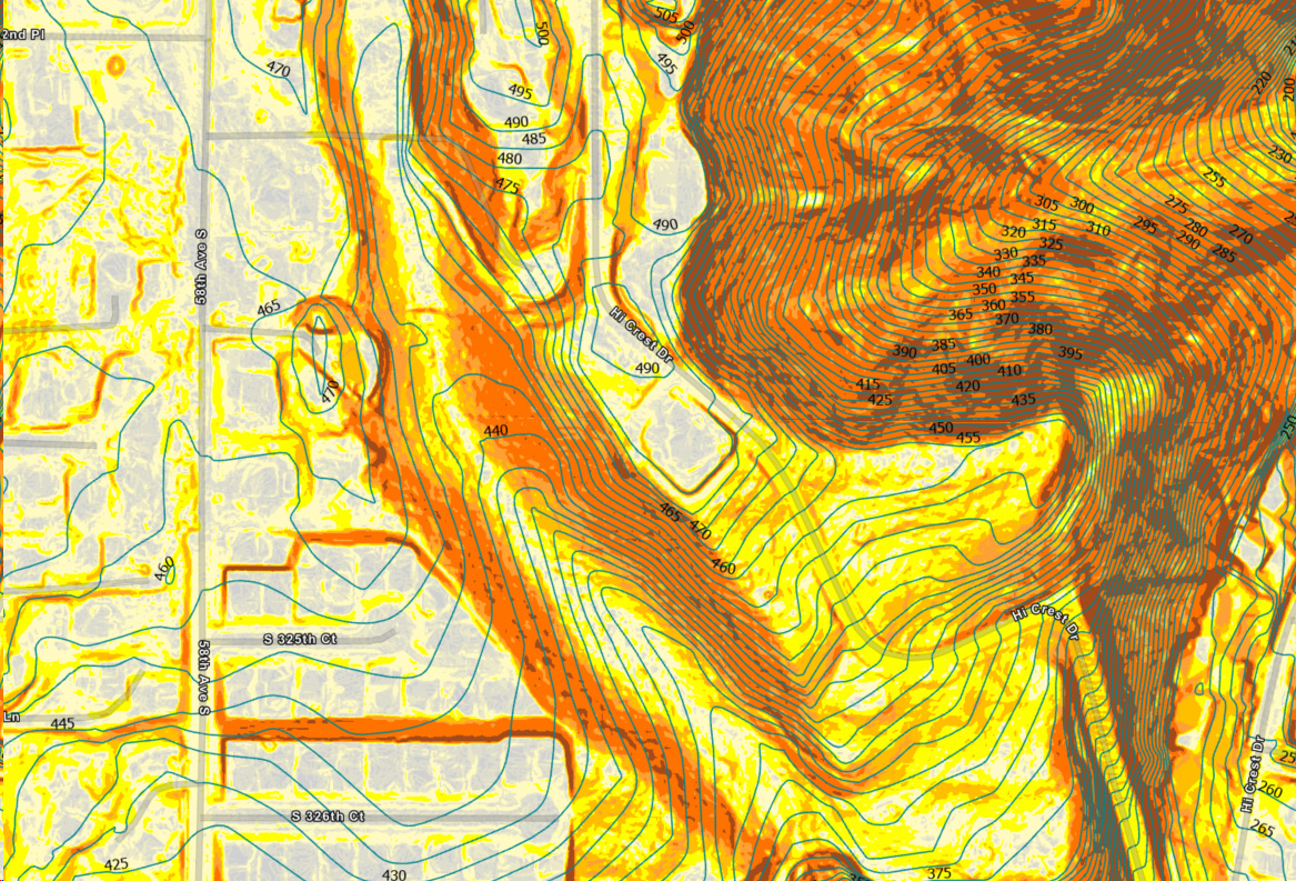
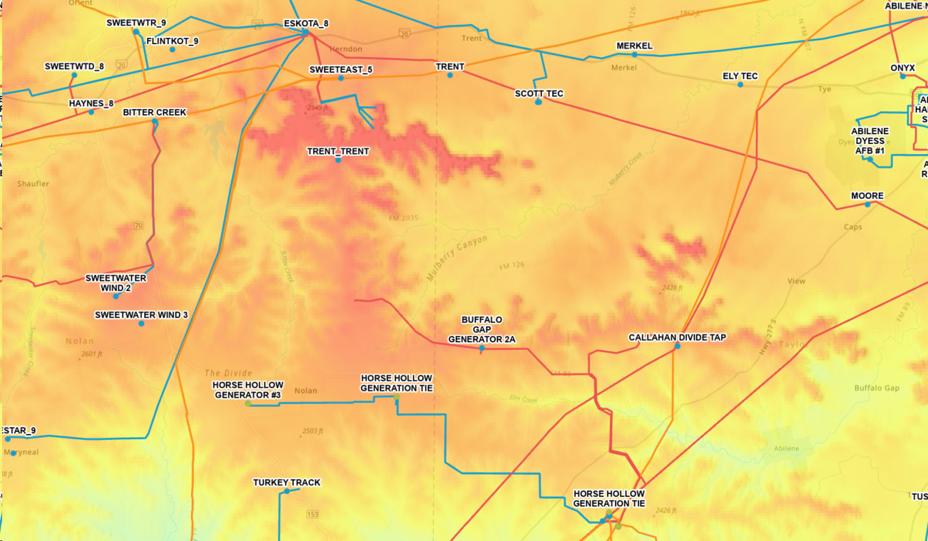
Slope/ Contours Maps
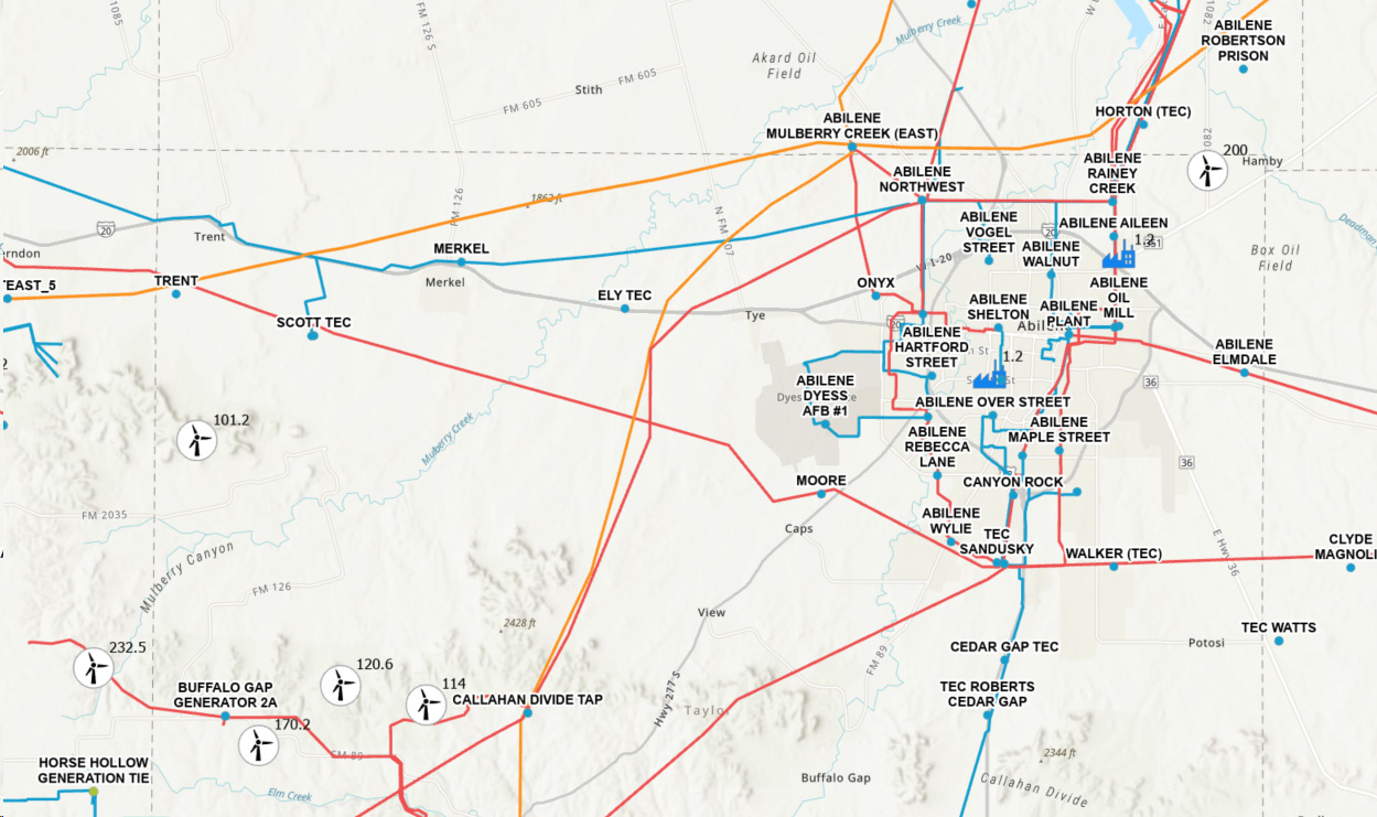
Existing Generation Maps
Wind Speed Maps
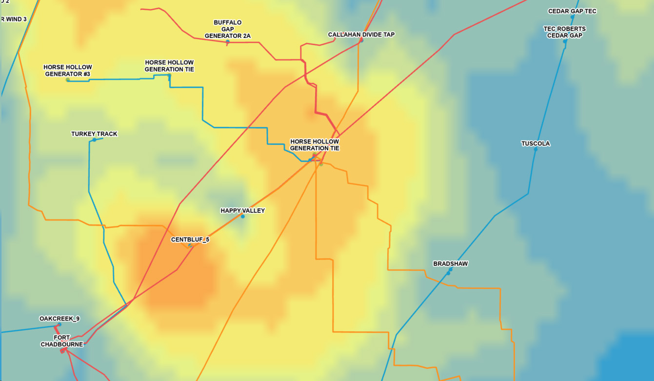
Load Available Transfer Capacity
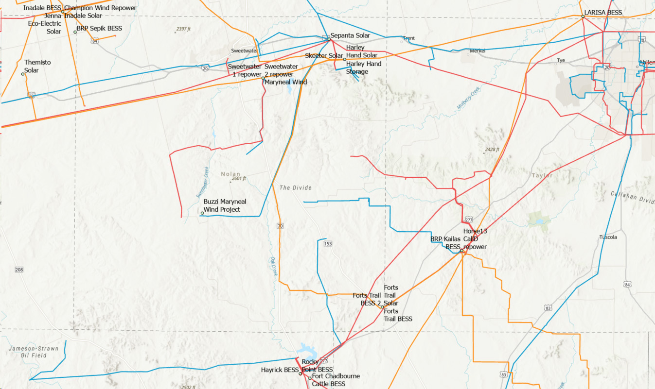
Queue Projects
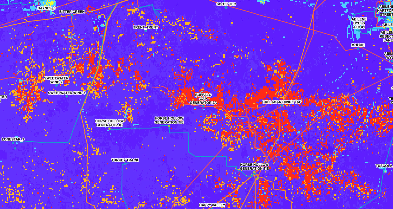
Injection Capacity Heat Maps
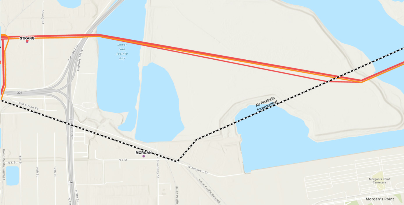
Hydrogen Infrastructure Maps
Available Withdrawal/ Load Transfer Capacity Maps
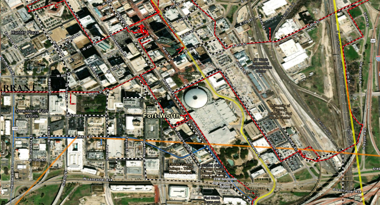
Fiber Carrier Maps